The Mind-Boggling Scale of Mount St. Helens’ Crater

On this day in 1980, an earthquake beneath Mount St. Helens got everyone’s attention. Within two months, much of her summit would be lying on the North Fork Toutle River valley floor, the lush forests stripped away, and our views of her changed forever.

Image shows Mount St. Helens, rays of sunshine striking it from low in the west and a thick white cloud over its summit. I'm standing on a grassy ridge to the right, almost invisible due to shadows and my black trench coat. I look very small in comparison to the enormous mountain many miles away.
C’mon, sweetie! Just a little eruption for your Aunty Dana. Please?! Image courtesy Suzanne B., used with permission.

My dear friend Suzanne took the above photograph during one of our visits. Perspective makes the grass look almost as tall as me -but it’s waist-high at best, possibly shorter. I was completely entranced by the mountain, so I didn’t notice the exact height. But I’d probably remember slogging through something trying to poke me in the eyeballs. And, of course, the volcano towers over us all, even though it’s off in the distance up and across the broad valley.

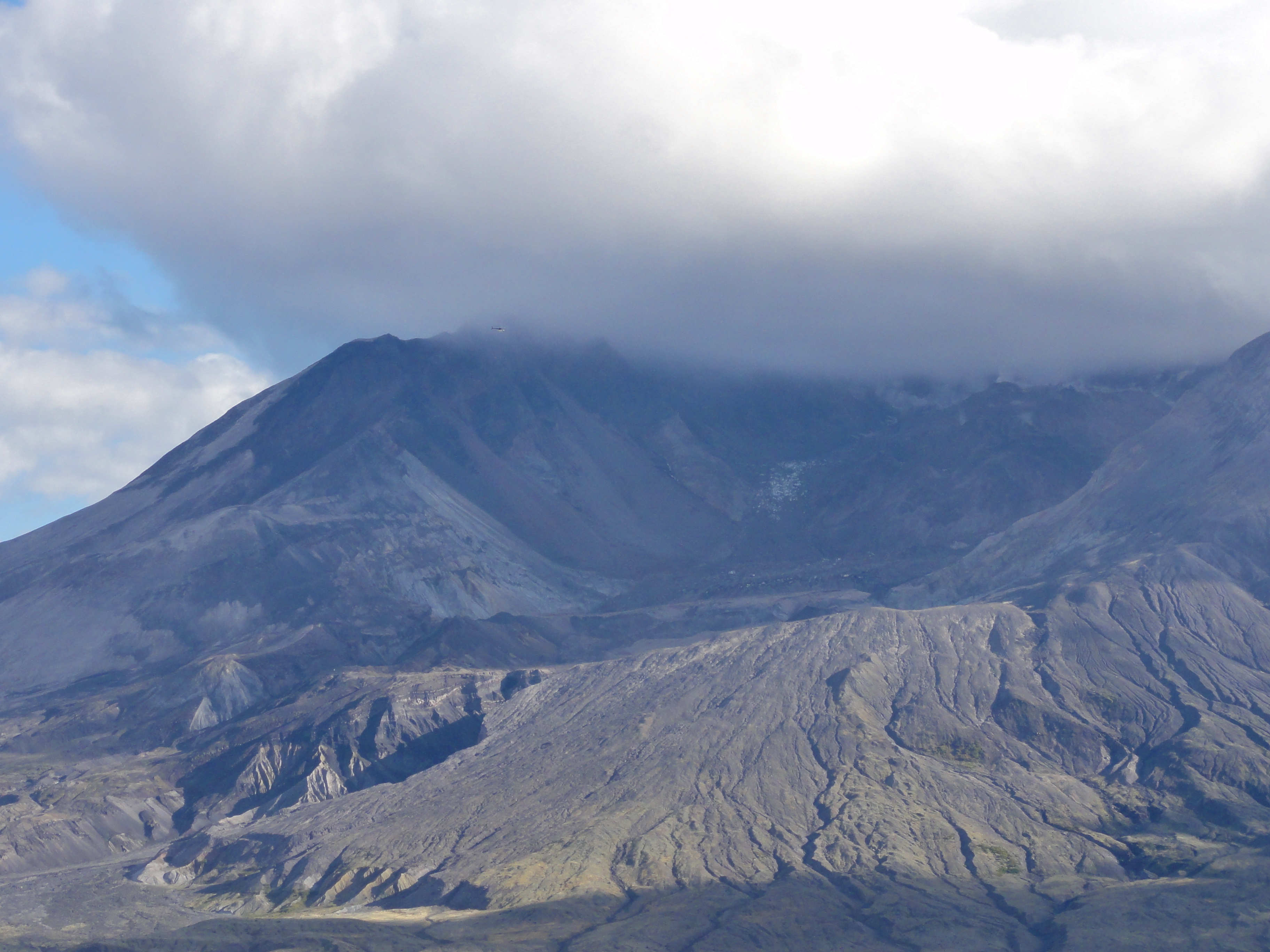
It’s not just perspective that makes Mount St. Helens look so huge. It is so huge! To give you an idea of how huge, even with nearly two thousand feet of its summit missing, check this out:

Image shows a portion of Mount St. Helens. The upper rim of the crater is obscured by cloud, but the interior of the crater, exterior wall, and ramp of pyroclastic deposits spilling from the gap in the rim are all visible. The dome is a low, wide mound within. The helicopter is flying past the rim. It's only a few pixels wide and virtually invisible.
Mount St. Helens and the helicopter. No, seriously, there’s a helicopter in this photo!

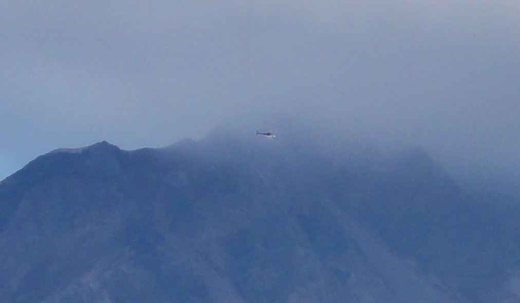
Can you see the helicopter in that photo I took? No? Let me crop that for you:

Image is a crop of the previous, showing a piece of the crater rim and the overlying cloud. The helicopter is just visible as a tiny streak between the cloud and the crater.
Can you see me now?

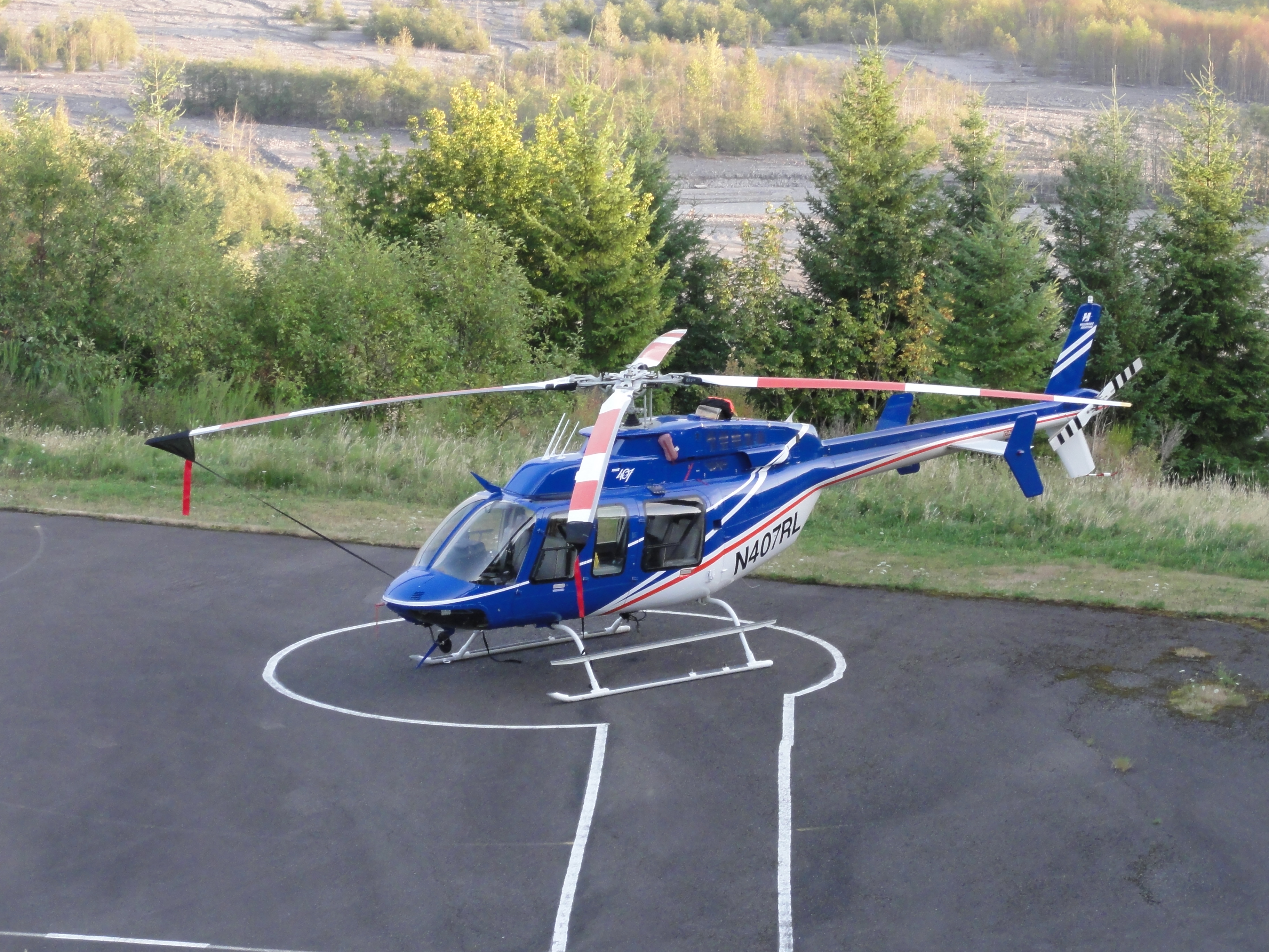
Yep, that wee spec is a Bell JetRanger, which is about 40 feet long. Here’s one parked at Hoffstadt Bluffs:

Image shows a blue helicopter with a white underbelly parked on a helipad. The Toutle River valley is visible behind it.
A tour helicopter parked at Hoffstadt Bluffs. Image by Dana Hunter.

And to give you some additional perspective, here are some people standing beside one.

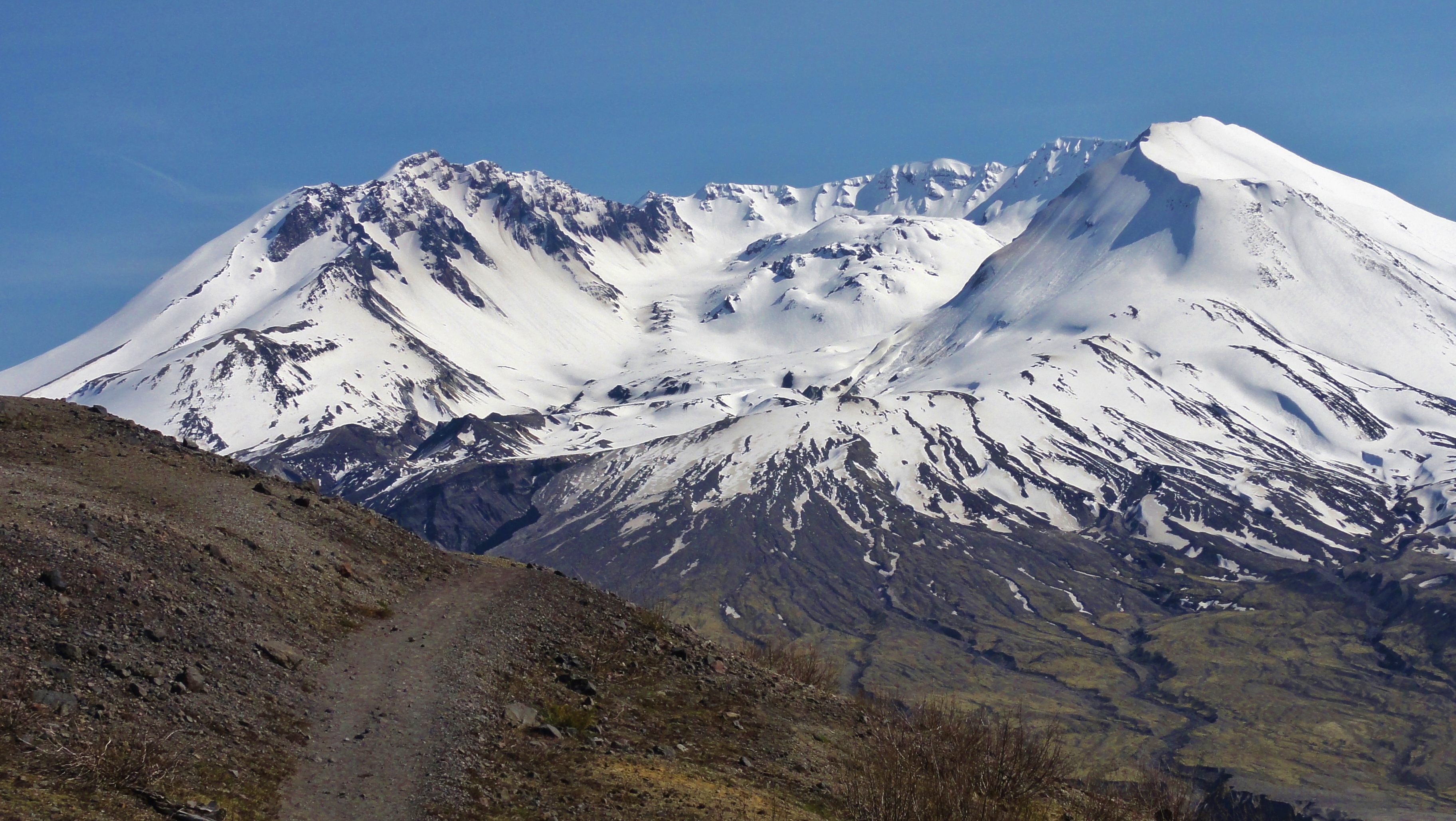
Alas, I have no photos of a helicopter right in the middle of the crater, but here’s a lovely shot from one of the trails at Johnston Ridge, showing you what’s inside.

Image shows a bit of dirt trail winding along the side of a bare ridge. It seems to vanish into the snow-capped crater of Mount St. Helens in the distance. The view shows the dome rising from the center.
Looking into the heart of destruction. Photo by Dana Hunter.

That mound of lava in the crater that looks like a blister? That’s around 1,000 feet tall. This pdf has a lot of stats on how big the dome is, all concluding: it’s huge. Yet it doesn’t even fill the crater left by the May 1980 eruption.

Amazing, isn’t it?


Originally published at Rosetta Stones.

{advertisement}
The Mind-Boggling Scale of Mount St. Helens’ Crater
{advertisement}