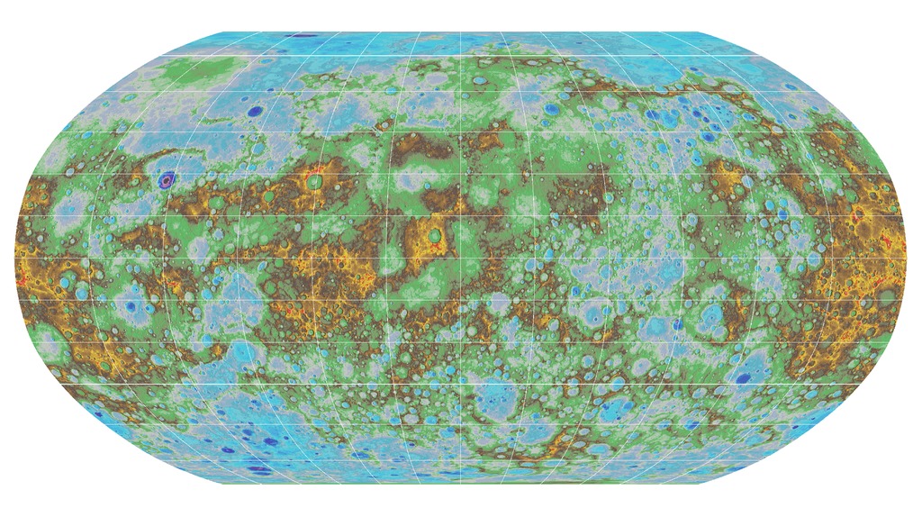
Want to see what a map of a brand-new and probably temporary island can tell us? Would you like to explore Mercury in all its topographic awesomeness? I’ve got a bit of both for you!
Maps are one of the most powerful tools humans have ever created. With a map, you can find your way around. You can organize information on all sorts of things: political affiliations, biospheres, changes in sea ice, migrations of people and animals. You can make maps that show regions changing over time, revealing history and telling stories. Geologic and topographic maps help us understand not only our world, but other worlds, too. Even the simplest maps can tell us important things about the places we’re studying. They can help us see things we never would have noticed without them.
We’ve recently mapped two places we’ve never mapped quite this way before. And the results are delicious….
Explore our brave new maps at Rosetta Stones.
Great maps and achievements here. Thanks Dana Hunter.
Have you also seen the new map made of Pluto here :
http://www.nasa.gov/image-feature/pluto-a-global-perspective
They’ll be better colour ones later too but for now, its already pretty impressive I think.